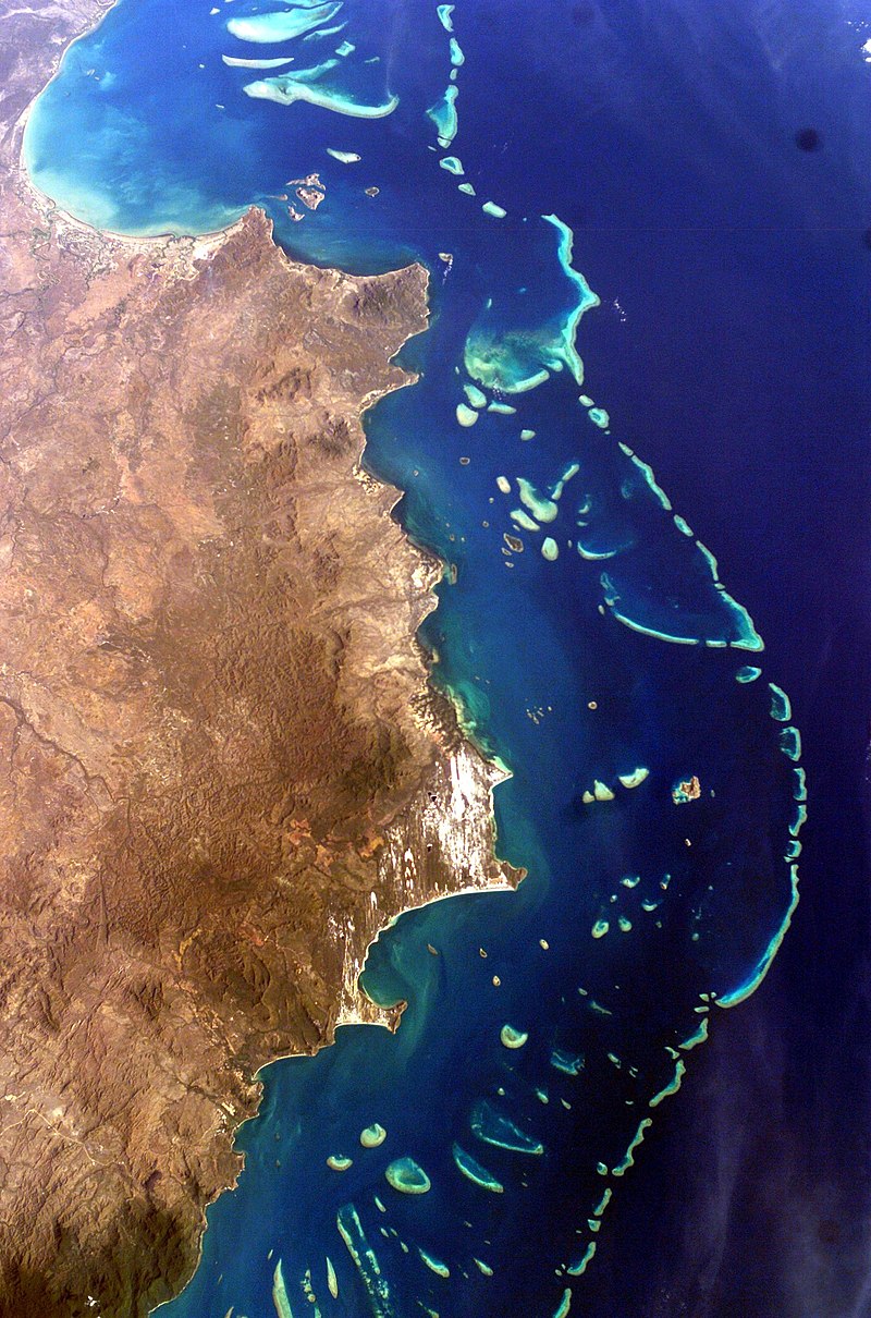
Great Barrier Reef
AUSTRALIA
Australia's Great Barrier Reef is the planet's largest coral reef system, with some 3,000 individual reefs and 900 islands stretching for 2,600 km over an area of approximately 344,400 square km. It is the biggest single structure made by living creatures and can be seen from outer space.
The Great Barrier Reef was one of Australia's first World Heritage Areas. It is the world's largest World Heritage Area, and is probably the best-known marine protected area in the world. It is the world's most extensive coral reef system and is one of the world's richest areas in terms of biological diversity.
The Great Barrier Reef stretches out for 2000 km along the coast from the very northern tip of Queensland, Bamaga, to Bundaberg, better known as the Capricornia section of the Reef (it actually goes on until Papua New Guinea).
Cairns is one of the major points from which to set off for a trip to the reef. Although you can reach many spots from whatever place on the eastern coast of Queensland, many people opt for Townsville.
From Townsville, you can easily set off for the Great Barrier Reef Marine park, that consist of hundreds of impressive uninhabited island with secluded beaches. You can stay for a few days and explore the reef area with snorkelling or diving equipment. The closest island to the coast is Long Island and visited by many people who want to explore the barrier reef for only a day or a few hours. Maybe it’s a good idea to set off for one of the many other islands or islands groups such as the Whitsunday Islands or the Molle Islands. Daydream Island, Hook Island, Lindeman Island or Hamilton Island. And these are only a few of the many.


Matterhorn
Italy/switzerland
The Matterhorn is the most familiar mountain in the european alps. With its 4,478 metres (14,692 ft) high summit, lying on the border between Switzerland and Italy, it is one of the highest peaks in the Alps and its 1,200 metres (3,937 ft) north face is one of the Great north faces of the Alps.
The mountain overlooks the town of Zermatt in the canton of Valais to north-east and Cervinia in the Aosta Valley to the south.
Although not the highest mountain in Switzerland, the Matterhorn is considered to be an iconic emblem of the Swiss Alps in particular and the Alps in general.


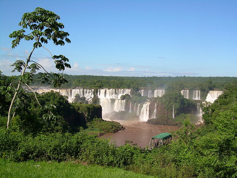
Iguazu Falls
ARGENTINA/ BRAZIL
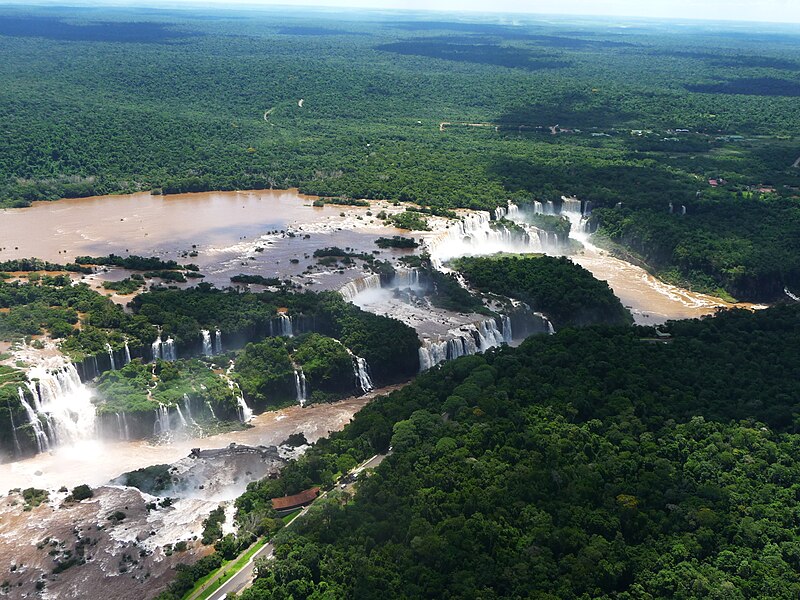
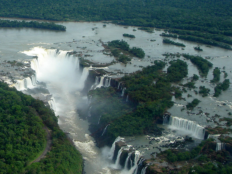
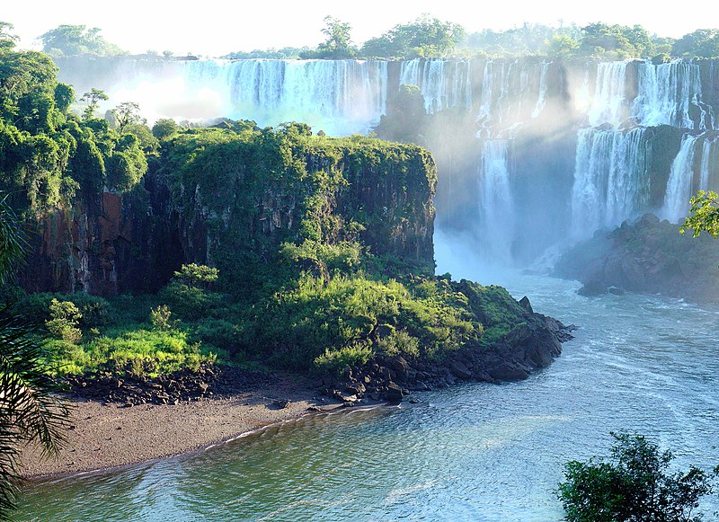
Iguazu Falls, in Iguazu River, are one of the world's largest waterfalls. They extend over 2,700 m (nearly 2 miles) in a semi-circular shape.
Iguazu falls are the second largest in the world after Victoria Falls in Africa and are deservedly one of the seventh wonders of the world. Their height isn't so inspiring as is their length - the falls seem to go on and on in the distance. When the water level of the river is high, the whole ridge is almost covered in the huge expanse of water pouring over. At other times, when the river level is lower, the amount of water is less and trees are rocks jump out from the fall wall providing a beautiful break in the water. Their are multiple approaches to the falls, both from above and below.
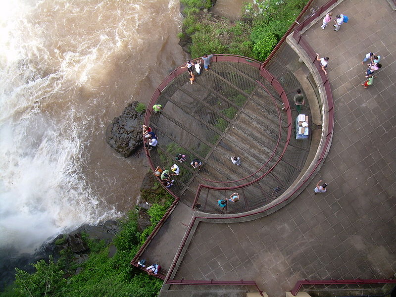
At some points you can get so close that you will feel the spray from the falls on your face. The Iguazu falls is formed at the edge of a volcanic flow where the rock suddenly changed hardness and wore away. What's sad is there was a second, even larger, fall that was destroyed when the river was dammed.
For those who would like to see the falls from both sides, it is only a short taxi ride across the border to Brazil. It is suggested that the Brazil side should be seen first, as, although stunning, is not quite as awesome as the Argintinian side, and this way leaves the best until last.


Black Forest
GERMANY
The Black Forest is a wooded mountain range in Baden-Württemberg, southwestern Germany. It is bordered by the Rhine valley to the west and south. The highest peak is the Feldberg with an elevation of 1,493 metres (4,898 ft). The region is almost rectangular with a length of 200 km (120 mi) and breadth of 60 km (37 mi). Hence it has an area of approximately 12,000 km2 (4,600 sq mi).
Geologically, the Black Forest consists of a cover of sandstone on top of a core of gneiss and granites. Formerly it shared tectonic evolution with the nearby Vosges Mountains. Later during the Middle Eocene a rifting period affected the area and caused formation of the Rhine graben. During the last glacial period of the Würm glaciation, the Black Forest was covered by glaciers; several tarn lakes such as the Mummelsee are remains of this period.


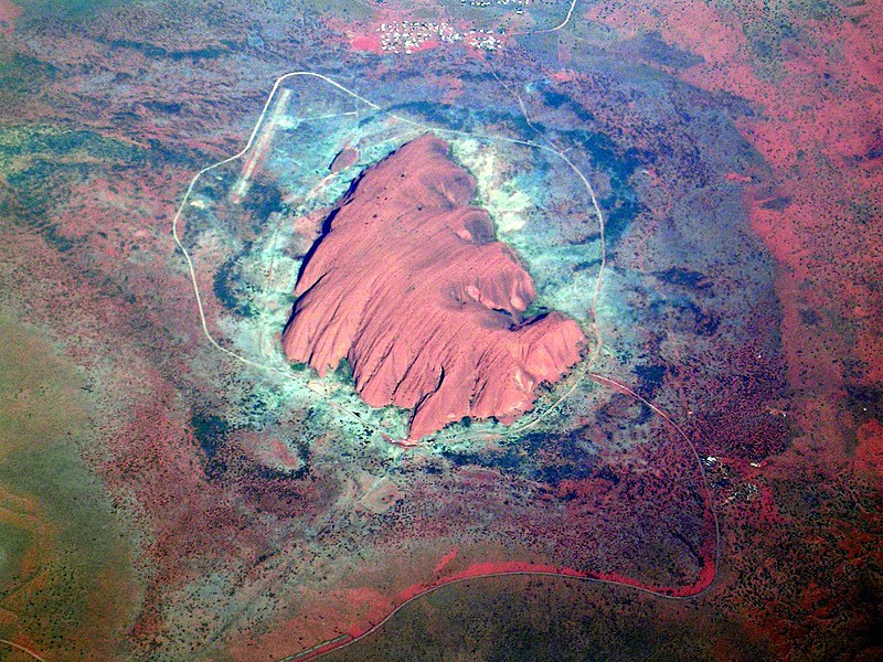
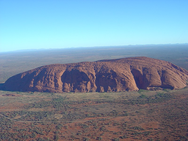
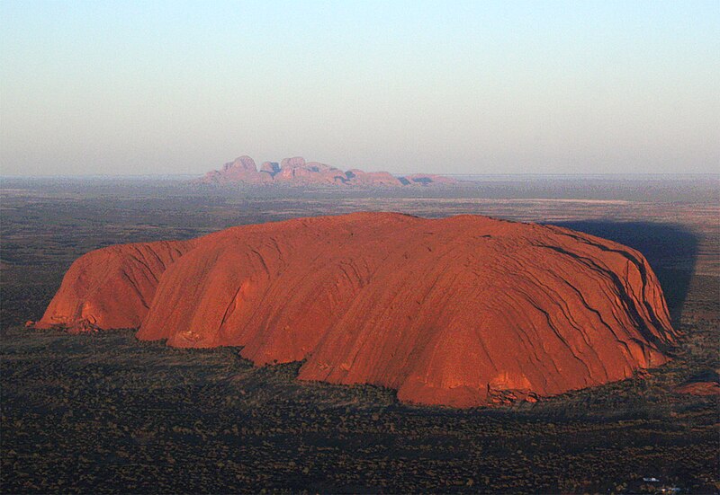
Uluru / Australia
Uluru (Ayers Rock) is one of Australia's most recognisable natural icons. The world-renowned sandstone formation stands 348 m high above sea level with most of its bulk below the ground, and measures 9.4 km in circumference. Uluru appears to change color as the different light strikes it at different times of the day and year.
Uluru is an inselberg, literally "island mountain", an isolated remnant left after the slow erosion of an original mountain range. Uluru is also often referred to as a monolith, although this is a somewhat ambiguous term that is generally avoided by geologists. The remarkable feature of Uluru is its homogeneity and lack of jointing and parting at bedding surfaces, leading to the lack of development of scree slopes and soil. These characteristics led to its survival, while the surrounding rocks were eroded. For the purpose of mapping and describing the geological history of the area, geologists refer to the rock strata making up Uluru as the Mutitjulu Arkose, and it is one of many sedimentary formations filling the Amadeus Basin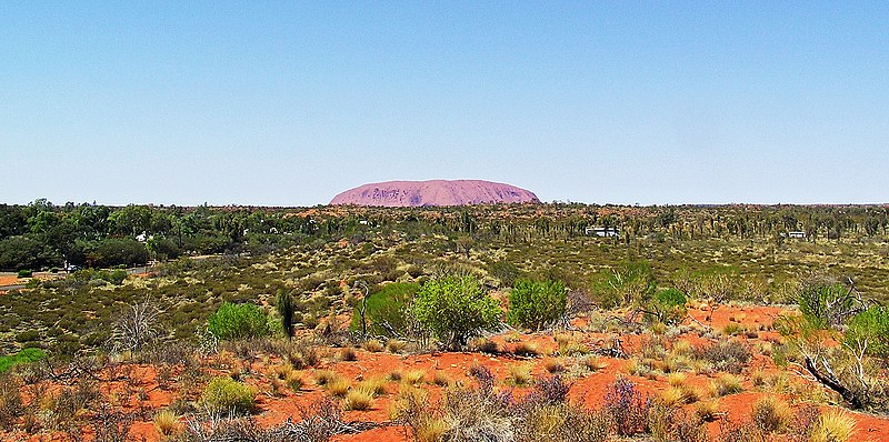


 See All Travel Photo Galleries
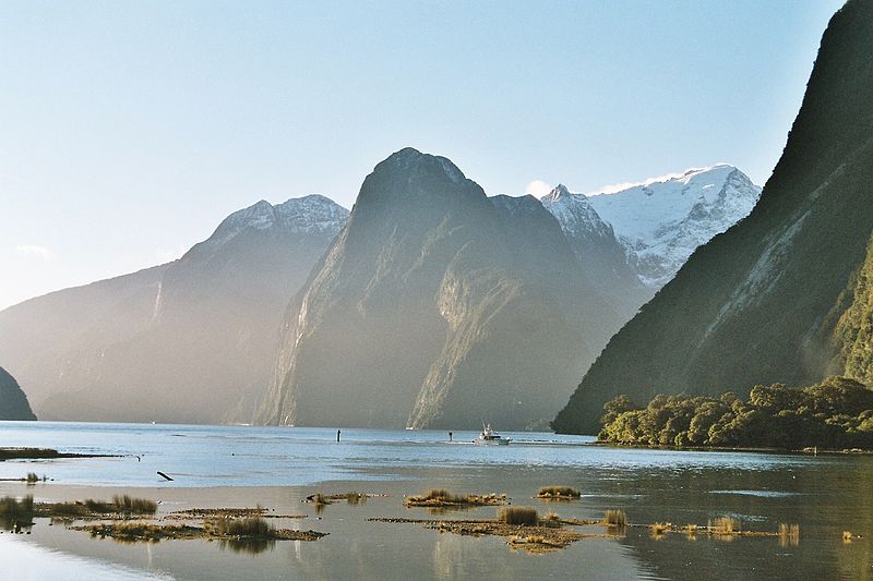
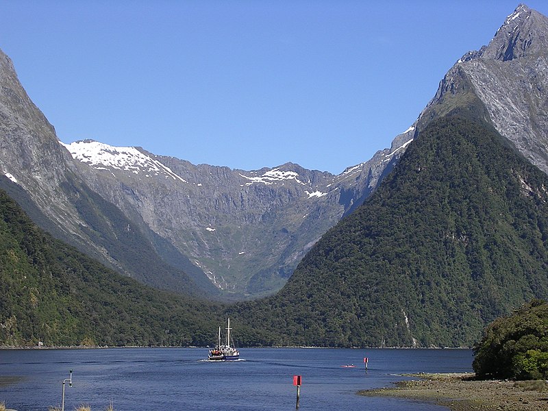
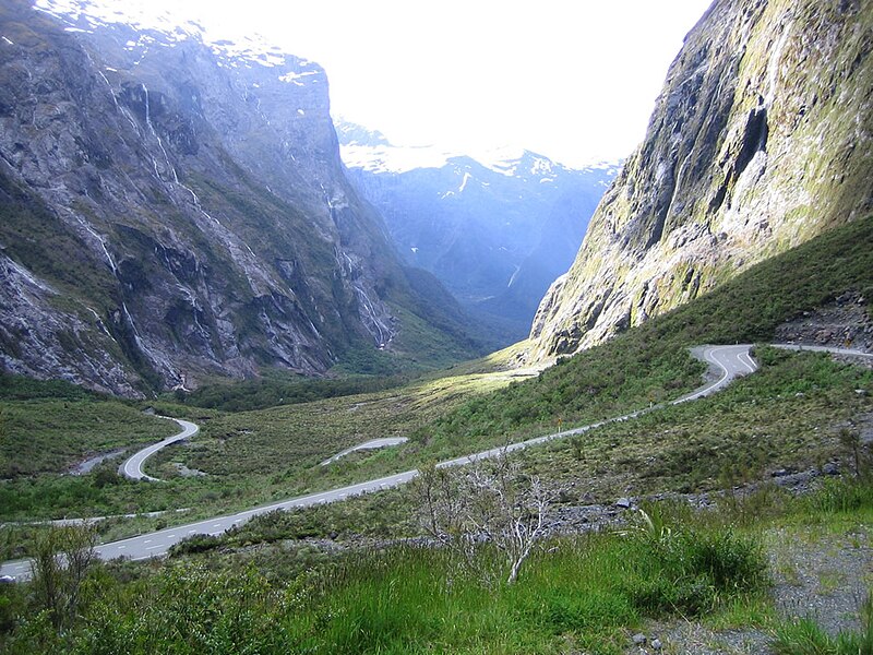
Milford Sound
NEW ZEALAND
Milford Sound, located in the southwest of New Zealand’s South Island, is located within the Fiordland National Park. It runs 15 km inland from the Tasman Sea and is surrounded by sheer rock faces that rise 1200 m or more on either side. Among its most striking features are Mitre Peak, rising 1,692 m above the sound, the Elephant at 1,517 m and resembling an elephant’s's head, and Lion Mountain, 1,302 m, in the shape of a crouching lion. Lush rain forests cling precariously to these cliffs, while seals, penguins and dolphins populate the water.
The beauty of this landscape draws thousands of visitors each day, with between 550,000 and 1 million visitors in total per year.This makes the sound one of New Zealand's most-visited tourist spots, and also the most famous New Zealand tourist destination, even with its remote location and the long journey from the nearest population centres. Almost all tourists going to the sound also take one of the boat tours which usually last between 1–2 hours. They are offered by several companies, departing from the Milford Sound Visitors' Centre. There is also the option of extended overnight cruises on Milford Sound.
Tramping, canoeing and some other water sports are also possible. A small number of companies also provide overnight boat trips. There is otherwise only limited accommodation at the sound, and only a very small percentage of tourists stay more than the day.
An underwater tourist observatory found in one of the bays of the sound provides viewing of black coral, usually only found in much deeper waters. A dark surface layer of fresh water, stained by tannins from the surrounding forest, allows the corals to grow close to the surface here.
In rainy and stormy days tourists can admire the play of the wind with the numerous waterfalls in Milford Sound. When meeting the cliff face the powerful wind often goes upward and waterfalls with a vertical drop get caught by wind, causing the water to go upwards.